North Carolina Waterfalls
With more than 250 cascades, the Appalachian mountains and hills of western North Carolina are a waterfall lover's paradise. As a bonus, some of the state's largest and most distinctive waterfalls are easily accessed and viewed along the corridor of Route 64, a scenic highway (a 61-mile stretch is aptly known as the 'Mountain Waters Scenic Byway'). The following driving tour may completed in a full day or less, though you'll want to allow plenty of time to explore the area. While not especially dangerous, drivers should be prepared for tight curves as the highway snakes through the mountains.
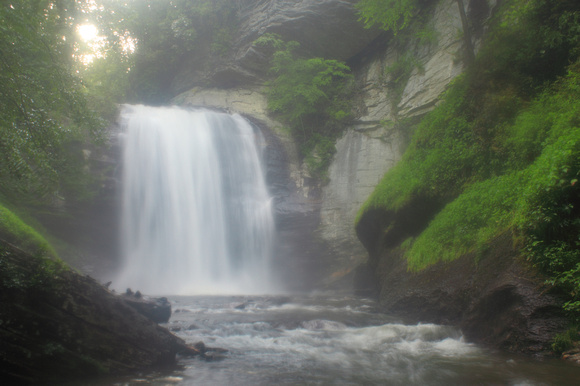
The first stop is Looking Glass Falls which, though not as large or voluminous as some of the other waterfalls, is arguably the most picturesque. From the junction of Route 64 and 276 east of Brevard, follow 276 north for 5.9 miles to the entrance on the right. For those travelling on the Blue Ridge Parkway, Route 276 and the falls are easily accessed at milepost 412.2 just west of the Mount Pisgah area. A set of stairs offers a quick descent to a viewing area and the base of the falls.


After enjoying the falls (and other attractions of the Nantahala National Forest) backtrack to Route 64 and head west for roughly 32.5 miles to Cashiers. Turn south on Route 107 for 9.3 miles to the South Carolina state line, then left at a sign for Whitewater Falls and continue 2.3 miles to the junction with Route 130 (becomes Rt. 281 in North Carolina). At 411 feet, Whitewater Falls is the highest waterfall east of the Rockies. A paved, universally accessible trail leads to two viewing areas with long-distance views of the falls across the high valley. A medium-range telephoto lens is helpful here to zoom in on the cascades.
Return to Route 107 and head back to Cashiers. From the town center, you can continue north on Route 107 to a right on Norton Road, which leads 0.5 miles to Hurricane Falls. This 30-40 foot falls is visible from the roadside.
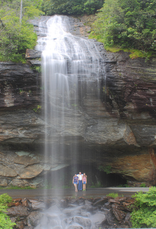
From Cashiers, continue west on Route 64 for 10 miles to Highlands. Here you will find popular Bridal Veil Falls, a true 'roadside attraction' in that part of the pulloff runs directly below the falls (below, a family poses beneath the cascades)! Use caution parking around here.


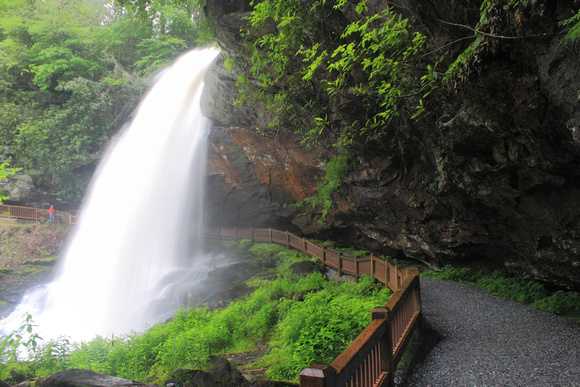
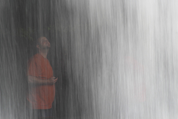
Just 0.9 miles further along is 75-foot high Dry Falls, which, in spite of its name and in contrast to nearby Bridal Veil Falls, often thunders with a high volume. One unusual characteristic of this falls is the trail that runs behind the cascade, allowing visitors an unique perspective.


The final stop on this tour is Cullasaja Falls. From Dry Falls, continue west on Route 64 for 5.5 miles to a viewing area at a pullout on the south side of the highway. Those stopping here should continue past the falls, then turn around and return in the eastbound lane to the pullout (use caution as the highway is quite narrow and windy here, and trucks and buses need the full width of the road).
Cullasaja Falls marks the western end of this tour, but there are many more attractions in the area worth exploring. From Franklin, several highways lead north towards the Smoky Mountains and Blue Ridge Parkway.