Easy White Mountain Hikes with Great Views
Exploring the White Mountains can seem daunting, as the region is home to New England's highest mountains and most rugged terrain, including nearly 50 peaks that exceed 4,000 feet. Fortunately, the region offers hundreds of miles worth of trails with a variety of options for hikers of all abilities, and a wealth of opportunities for photographers. Below are some recommended outings that offer great views of Mount Washington and the Presidential Range.
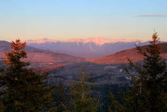
1. Mount Sugarloaf. This little mountain offers some of the finest views in New England per amount of effort. From the trailhead on Zealand Notch Road, the trail follows the river, then makes an easy climb past some giant glacial boulders. After a brief steep section, it reaches a notch between the north and middle summits. From here the trail to the right offers a short 0.3-mile climb to the north summit, where there are excellent views of Mount Washington, the Presidential Range, and the surrounding area. The route to the middle summit is slightly more rugged and requires a quick climb up a ladder. Though Zealand Notch Road is closed to traffic in winter, hikers can park at the nearby pullout on Route 302 and walk up the road to the trailhead.

 Late winter view of Mount Washington and the Presidential Range from North Sugarloaf.
2. Square Ledge. This massive rock outcropping is located on the slopes of Wildcat Mountain across from the AMC Pinkham Notch Visitor Center and offers a fine view of Mount Washington's east face. The trail begins opposite the visitor center on the east side of Route 16 and offers an easy to moderate 0.5-mile climb that gains 500 feet.
3. Lowe's Bald Spot. This longer outing along Mount Washington's lower east slopes leads to a rocky, partially open shoulder with excellent panoramic views of Mounts Adams and Madison, Boott Spur, the Lion's Head, and the valley to the north. The elevation gain is 850 feet. This trail also begins at the AMC visitor center and climbs gradually for 1.9 miles to cross the Mount Washington Auto Road near the 2 mile marker. It then follows the Madison Gulf Trail for 0.2 miles to a side trail that offers a quick climb to the outcropping and viewpoints. Backtrack for a 4.4-mile round trip.

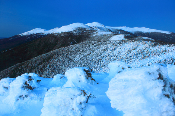
 A treeline view of Mounts Eisenhower and Washington from Mount Pierce.
4. Crawford Path to Mount Pierce. It may seem odd to include a 4312-foot peak of the Presidential Range in a list of easy hikes, but the historic Crawford Path, which was originally a bridle path, offers a moderate, well-graded climb along the southern Presidentials with no steep sections. From the area around Mount Pierce's summit there are outstanding views of Mount Washington and much of the Presidential Range, including Mount Eisenhower. From parking areas off of Route 302 in Crawford Notch near the AMC Highland Center, the Crawford Path leads past Gibbs Falls after roughly 0.5 miles and Mizpah Cutoff at 1.9 miles, then emerges from the trees below the summit, which it reaches at 3.2 miles.
Good luck exploring, and for more images and ideas feel free to visit the New Hampshire gallery: http://johnburk.zenfolio.com/p701332216